
Johnstons Run Waterway Assessment Results Overview - June 2014
Starting Fall 2012, utilizing a grant from the National Fish and Wildlife Foundation, Johnstons Run Revitalization Council has been working in collaboration with MACWell and local municipalities to restore Johnston Run as a “living waterway”. The run is on the Department of Environmental Protection list of impaired streams. Even without this label, locals can tell you that our water resource has been devoid of significant fish wildlife and has been murky with sediment from erosion and flooding for years – not a place where we would want our children to fish and play.
A watershed management plan has been developed for Johnston Run by KCI Technologies, Inc., a consulting firm experienced in water resources and land management. The first step for KCI was assessing the health and function of the stream, the adjoining flood plain, and watershed; they collected samples and recorded water pollution and degraded environmental conditions. This page includes the results of the Watershed Assessment.. You can also check out the Watershed Management Plan. For questions for KCI Technologies or for the Johnstons Run Revitalization Council please Contact Us
A watershed management plan has been developed for Johnston Run by KCI Technologies, Inc., a consulting firm experienced in water resources and land management. The first step for KCI was assessing the health and function of the stream, the adjoining flood plain, and watershed; they collected samples and recorded water pollution and degraded environmental conditions. This page includes the results of the Watershed Assessment.. You can also check out the Watershed Management Plan. For questions for KCI Technologies or for the Johnstons Run Revitalization Council please Contact Us
Stream Corridor Assessment (SCA) was completed through a "stream walk" and aerial view assessment of 2.5 miles of channel, documenting the location, type, and severity of stream corridor infrastructure and impacts to stream health. Assessed features include:
§ Stream bank erosion, riparian buffer, pipe outfalls, fish movement barriers, trash, channel alteration, active construction, exposed pipes and any unusual conditions.
§ Stream habitat assessment at representative locations.
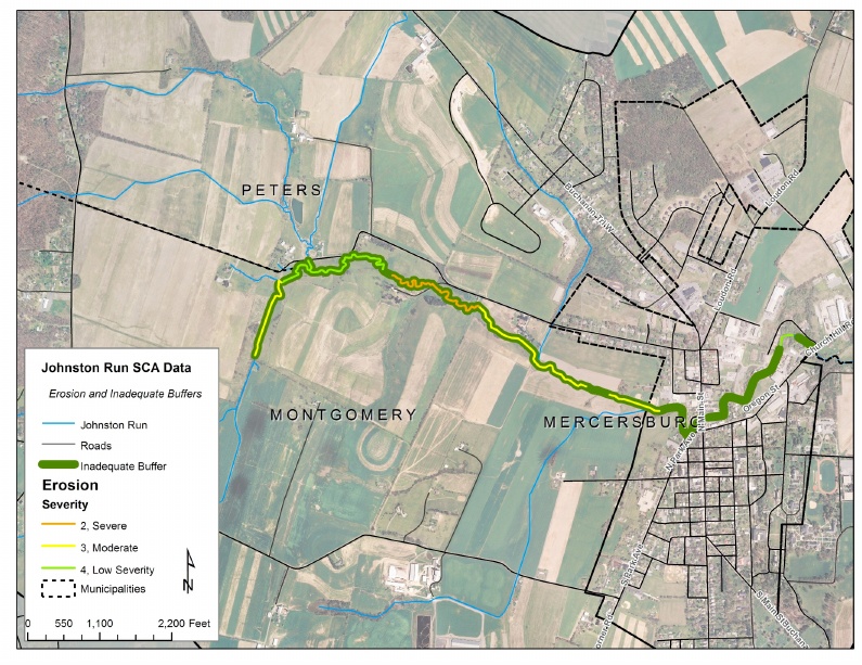
The map below shows areas of stream bank erosion and lack of adequate riparian buffer.
§ Stream bank erosion, riparian buffer, pipe outfalls, fish movement barriers, trash, channel alteration, active construction, exposed pipes and any unusual conditions.
§ Stream habitat assessment at representative locations.
The map below shows areas of stream bank erosion and lack of adequate riparian buffer.
|
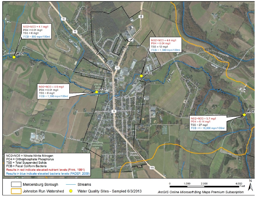
Water Quality Sampling includes:
o Physical parameters measured in-stream - dissolved oxygen, pH, temperature, conductivity and turbidity. o Chemical parameters - total suspended solids, alkalinity, nutrients (nitrogen, phosphorus), zinc, iron, chloride, sulfate, fecal coliform bacteria and total organic carbon. The Map Below shows elevated nutrients and bacteria, increasing as you progress down stream. The chart shows sources of the various pollutants. |
Biologic Sampling (Scroll down to fascinating description)
o Benthic macroinvertebrates (What's Benthic? Scroll Down) o Fish assemblage sampling o Physical habitat Significance of results - Benthic macroinvertebrate sampling indicates that Johnston Run is impaired and is not fully meeting its aquatic life use potential. The samples in general were characterized by low diversity and a dominance of organisms that are tolerant of pollution. |
|
Sources for nutrient excess and coli-form bacteria are multiple and can be urban as well as agricultural.
The Watershed Management Plan provides us with the opportunity and directions to revitalize Johnstons Run, and develop an educational program and monitoring system to sustain watershed health. It invites us all to be good stewards of our waterways. To review the complete Watershed Assessment and Management plan for Johnstons Run will be visit our Franklin County Conservation District website: http://www.franklinccd.org/WatershedProgram.html 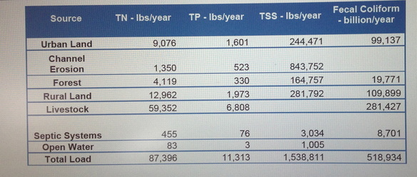
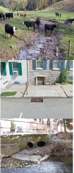
Photos show Agricultural and Municipal sources of pollutants. Municipal sources include oil, salt, dirt pet debris from the roads, everything people dump in the gutters and sewers, and fertilizer from lawns.
|
|
Johnston Run Waterway Revitalization In Progress - July 2013
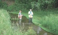
To develop our Watershed Management Plan for Johnstons Run, KCI Technologies, Inc., a consulting firm experienced in water resources and land management assessed the health and function of the stream, the adjoining flood plain, and watershed; they collected samples and recorded water pollution and degraded environmental conditions. Thank you to the Mercersburg Journal for featuring this article with updates on the Revitalization project. Check it out to learn more about our "Limestone Stream" and the assessment process.
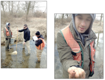
Counting Fish, July 2013
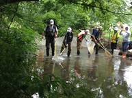
A great deal of observation, research and care goes into understanding our waterways. Here the team goes out to walk the stream and count fish! The type of fish indicates the nutrient and sediment content impacting the health of the stream.
The Fascinating Process of Waterway Assessment - Who Knew?
The Johnston Run Assessment has begun! Do you know the importance of a "riparian buffer"? Or how fish and insects respond to pollution? Find out here what a Waterway Assessment involves! It's actually a very interesting and intricate process designed to measure a number of factors that indicate waterway health. In this article, Liz George takes you along for a waterway hike with our team of environmental scientists from KCI Technologies!
Click on the Pics to read the article published in The Mercersburg Journal
Click on the Pics to read the article published in The Mercersburg Journal
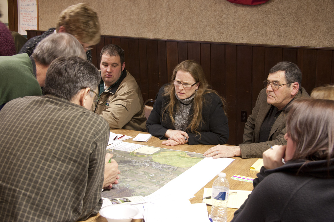
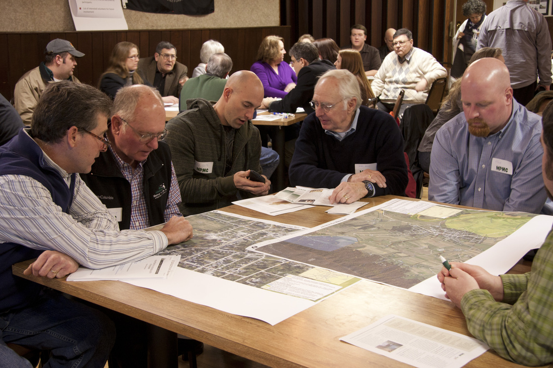
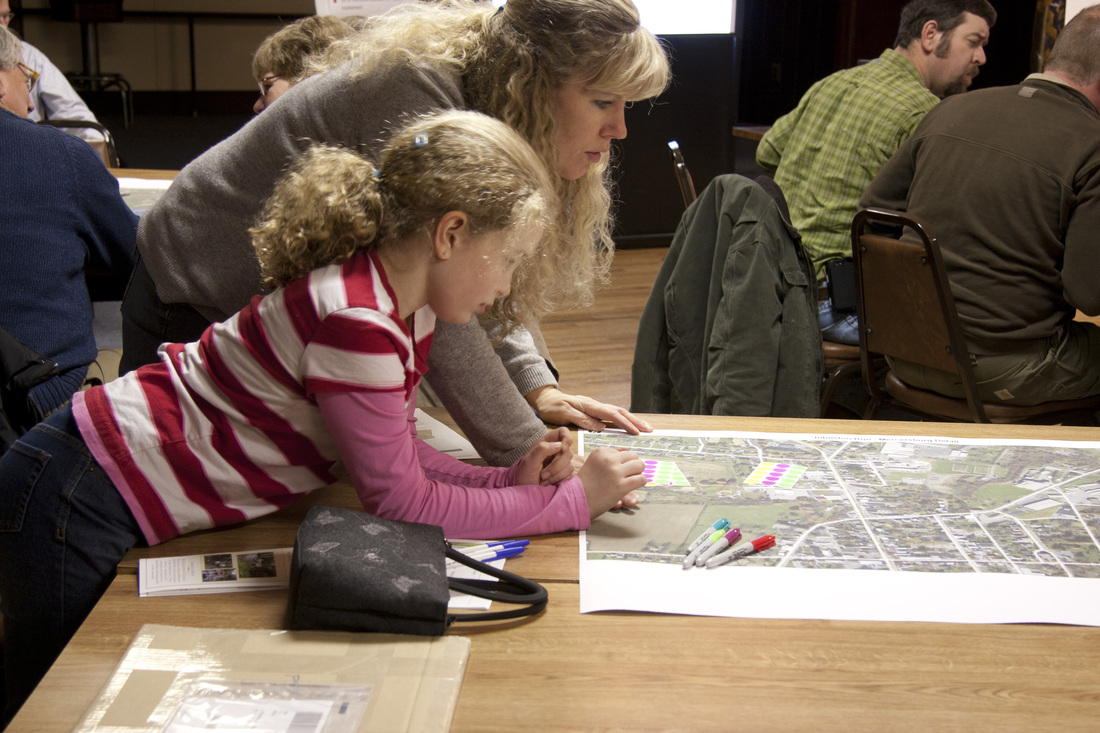
The Process Began with a Community Workshop. Participants saw a powerpoint on the complexity of our watershed and the key role it plays in the health of the community, streams beyond us and the Chesapeake Bay. Maps of the watershed were reviewed and concerns about various areas added to initial data.
Tree Planting to Restore the Riparian Buffer, April 2013
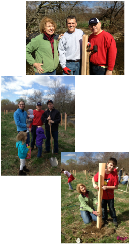
Johnston Run Waterway Revitalization Council members Liz George and Elizabeth Grant, and volunteer Nancy Schultz attended a morning of tree planting on Antietam Meadow in Waynesboro PA to help restore the riparian buffer; the hands on experience will be helpful when the Johnston Run restoration project moves from waterway assessment to action. Over 30 volunteers gathered and were taught the technique to plant the bare root saplings and secure the protective tube (lets in light and water but not deer or voles). Over 500 native trees and shrubs were planted along Antietam Creek before the morning was over - some can be seen in the photos. This project will restore several thousand feet of stream bank, reduce erosion and shade the stream to maintain cooler water temperatures that help keep these ecosystems healthy. Antietam Watershed Association and Washington Township partnered with the Chesapeake Bay Foundation. We also had an opportunity to learn about the Conservation Reserve Enhancement Program (CREP) - a voluntary conservation program that pays landowners to plant trees along streams.
Photos:
MPMC Chair Liz George joined with Washington Township Manager Christopher and PA State Representative Todd Rock to plant trees along Antietam Creek
Franklin County Commissioner Dave Keller brought his family to help with the riparian buffer restoration. (shown with Manager Christopher)
Team work by Liz George and Geoffrey Souza and his dad David Souza of Hagerstown Md
